Surveying
Surveying Services in Maine, Massachusetts, Connecticut, New Hampshire and Florida
At Haley Ward, we provide a complete range of professional surveying services to support projects of all sizes, from small residential lots to large-scale commercial and infrastructure developments. With offices across Maine, Massachusetts, Connecticut, New Hampshire, and Florida, our team combines local knowledge with the latest surveying technologies to deliver accurate, reliable, and timely results.
Our surveying division is staffed with highly skilled professionals who bring decades of combined experience in the field. We invest in advanced equipment and software to provide precise measurements and comprehensive data for engineers, architects, contractors, municipalities, and private property owners. Whether the project involves land development, construction, environmental studies, or infrastructure upgrades, our surveyors deliver work that aligns with each client’s specific needs and project goals.
Comprehensive Surveying Services
We offer a full suite of surveying solutions, including:
• Drone Services – Our use of unmanned aerial vehicles (UAVs) allows for rapid data collection, high-resolution imagery, and accurate mapping over large or challenging areas.
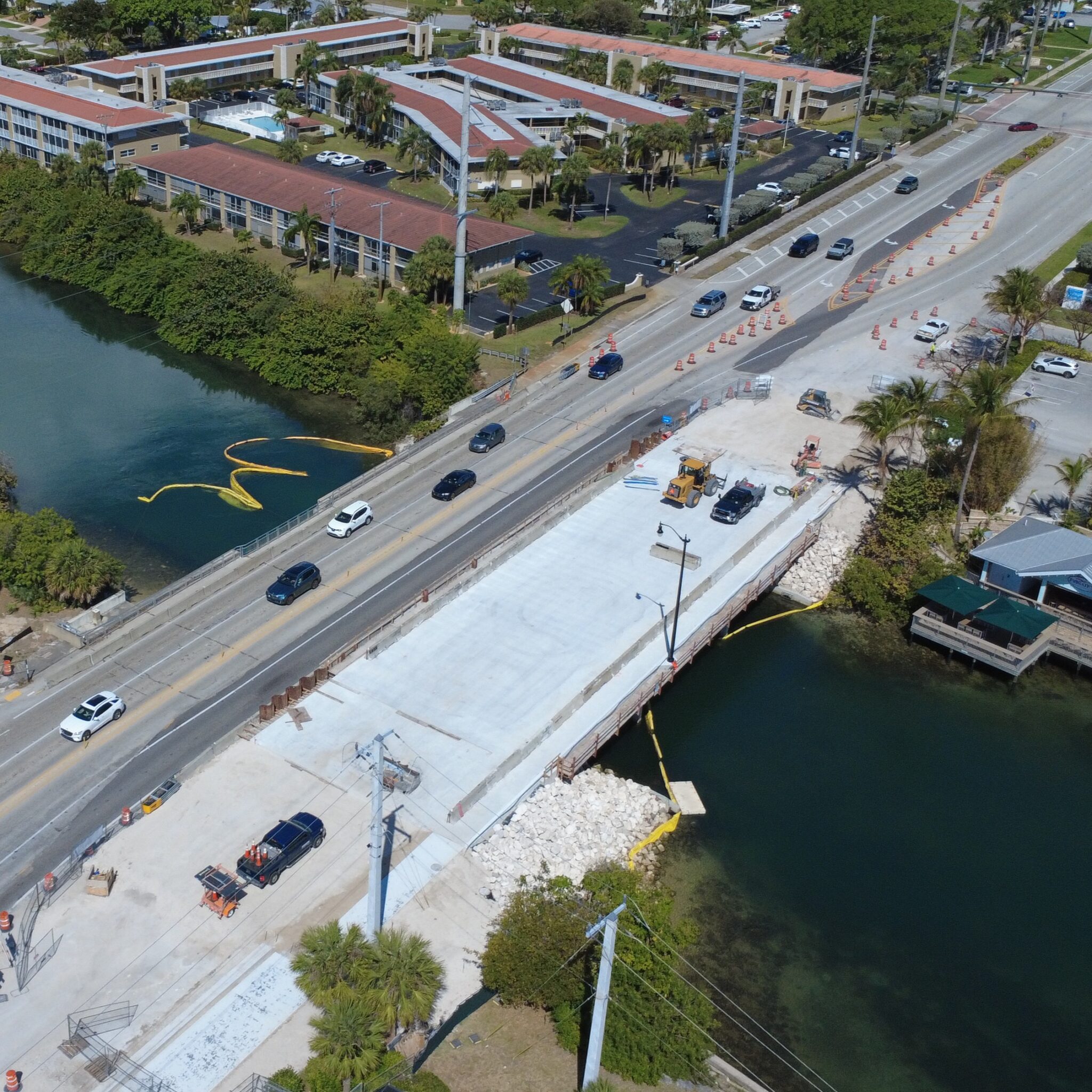
• Boundary Surveys, Topographic & Utility Surveys – We determine property lines, map terrain features, and locate existing utilities to guide site planning and design.
• ALTA/NSPS Land Title Surveys – These detailed surveys meet the highest industry standards for commercial transactions, providing vital information for lenders, title companies, and attorneys.
• Aerial Ground Control & Photogrammetry – We provide precise ground control points and 3D photogrammetry to support aerial mapping projects.
• Construction Layout, As-Built & Anchor Bolt/Steel Frame Surveys – From initial layout to verification during construction, we provide the data needed to keep projects on track.
• Hydrographic & Bathymetric Surveys – Using specialized equipment, we measure and map underwater topography for harbors, rivers, lakes, and coastal projects.
• Site Assessment & Construction Monitoring – Our surveyors collect ongoing data to track progress, verify dimensions, and confirm compliance with design specifications.
• Interior Building Scanning – Using 3D laser scanning, we create highly accurate floor plans and conceptual models for renovations, expansions, or historical preservation.
• Underground Utilities & Subsurface Engineering Services – We locate, map, and document subsurface utilities to help prevent conflicts during excavation or construction.
Advanced Equipment for Precision Results
Our investment in advanced surveying technology allows us to handle complex projects efficiently and with exceptional accuracy. We use:
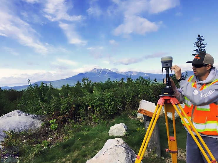
• RTK GPS (Survey Grade) for high-precision positioning in the field.
• Robotics for fast and accurate measurement without the need for multiple crew members on every shot.
• Phantom 4 PRO UAV (Drone) for aerial mapping and inspections.
• HyDrone Unmanned Bathymetric Survey Boat for safe, detailed underwater measurements.
• BLK 360 Laser Scanner for capturing millions of data points to create 3D models and point clouds.
Why Work With Haley Ward?
Our survey teams work closely with clients in Maine, Massachusetts, Connecticut, New Hampshire, and Florida to provide clear communication, practical solutions, and high-quality deliverables. We understand the regulations, terrain, and environmental considerations unique to each state, allowing us to address local requirements while applying proven surveying practices.
We take pride in tailoring our approach to each project. By selecting the most appropriate combination of tools and techniques, we provide data that supports informed decision-making throughout planning, design, and construction. Our crews are trained to operate efficiently in the field while maintaining strict attention to safety and accuracy.
Serving a Wide Range of Clients and Industries
Our surveying services support:
• Municipal infrastructure projects, such as roads, bridges, and utilities
• Commercial and residential land development
• Environmental and coastal restoration efforts
• Transportation and transit improvements
• Industrial facility expansions
• Real estate and property transactions
From the rocky coastlines of Maine to the bustling cities of Massachusetts, the scenic landscapes of New Hampshire, and the waterways of Florida, Haley Ward’s surveyors are equipped to provide dependable measurements and mapping wherever the project takes us.
Get Started with Haley Ward’s Surveying Team
Accurate survey data is the foundation of a successful project. If you are in Maine, Massachusetts, Connecticut, New Hampshire, or Florida and need professional surveying services, contact Haley Ward today to discuss your project’s requirements. Our team is ready to provide the precise information you need to move forward with confidence.
FEATURED CLIENTS
Hammond Lumber Company
- Boundary Topographic Surveys
- Construction Stakeout
- Drone Aerial Photogrammetry
Maine State Housing
- Boundary/Development Surveys
- ALTA/NSPS Land Surveys
Consigli Construction
- Construction Layout
- As-Built Including Anchor Bolts
- Existing Conditions Surveys
Heiderscheidt Residential Docking
- Bathymetric Surveys
- Hydrodrone
- NHDES Permitting