Community Vulnerability Assessment
Gardiner, Maine
Project Scope
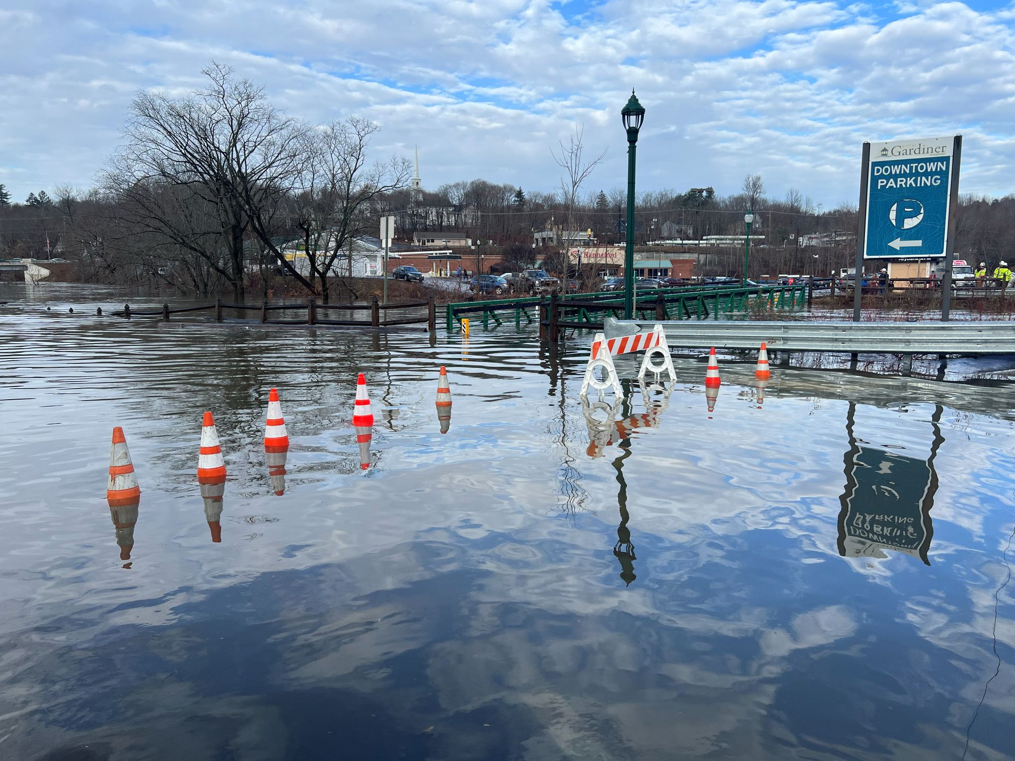
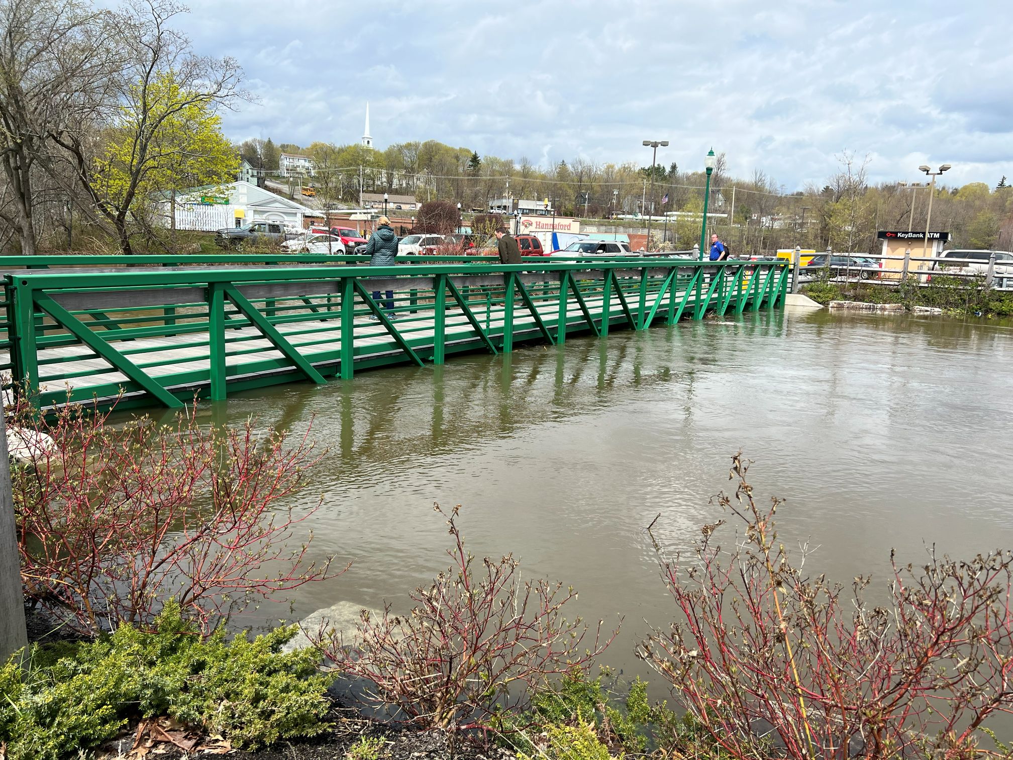
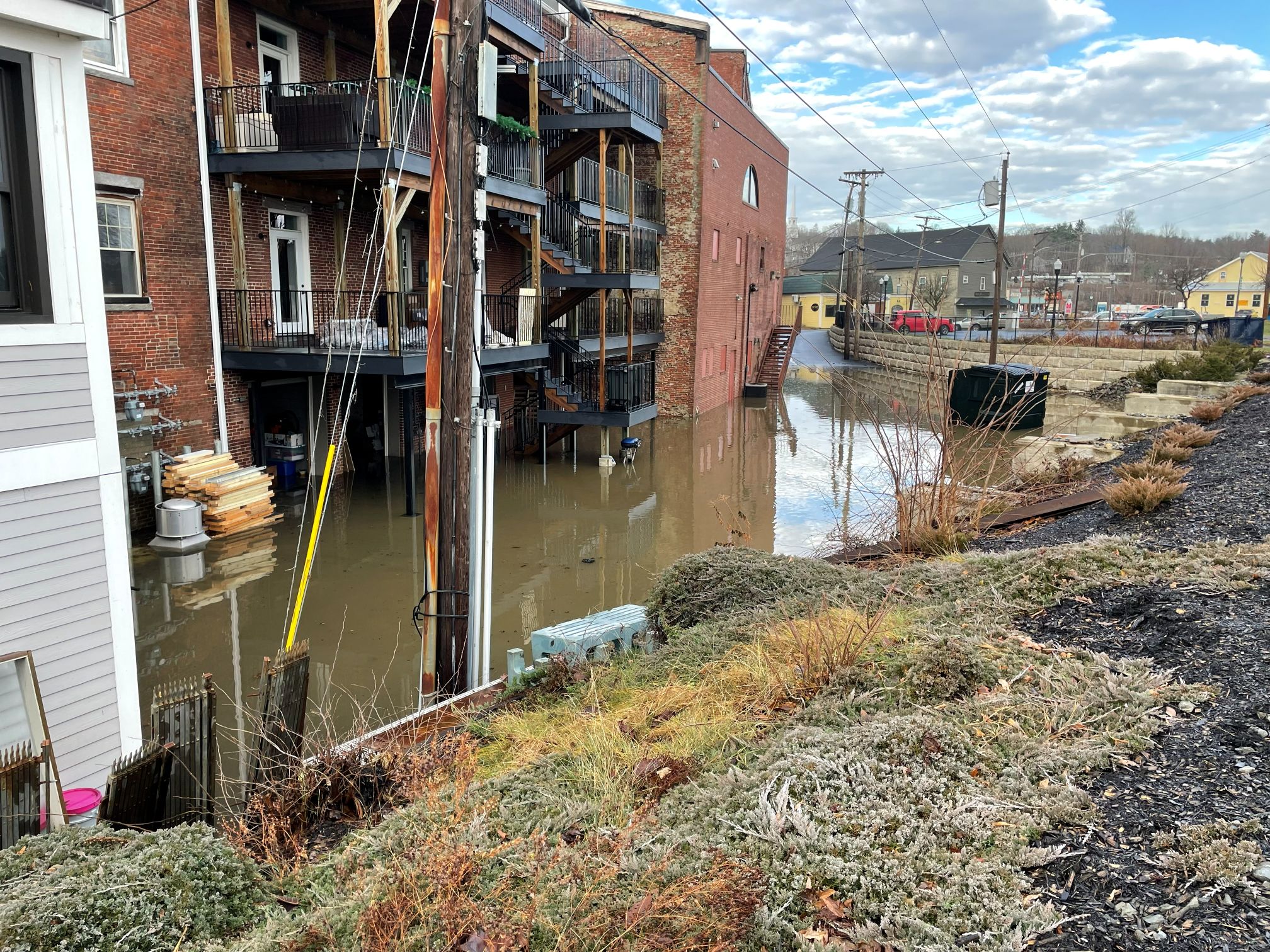
On December 19, 2023, the City of Gardiner experienced a devastating and historic flooding event. After a major winter storm, the Kennebec River crested at 19 feet, the highest level since the 1980s, and the downtown area was inundated. Businesses along Arcade and Water Street suffered significant damage, and the city responded by seeking a deeper understanding of future flood risks. Gardiner secured a Community Action Grant from Maine’s Governor’s Office of Policy Innovation and the Future through the Community Resilience Partnership and contracted with Haley Ward to complete a comprehensive Community Vulnerability Assessment.
The purpose of this assessment was to identify climate and environmental hazards, evaluate community and infrastructure vulnerabilities, and develop a practical strategy to help Gardiner reduce the impacts of future flooding. Through detailed geospatial analysis, hydrological inundation modeling, historical research, and broad community engagement, Haley Ward has worked closely with City staff and the project Work Group to build a clear and useful foundation for long-term resilience planning.
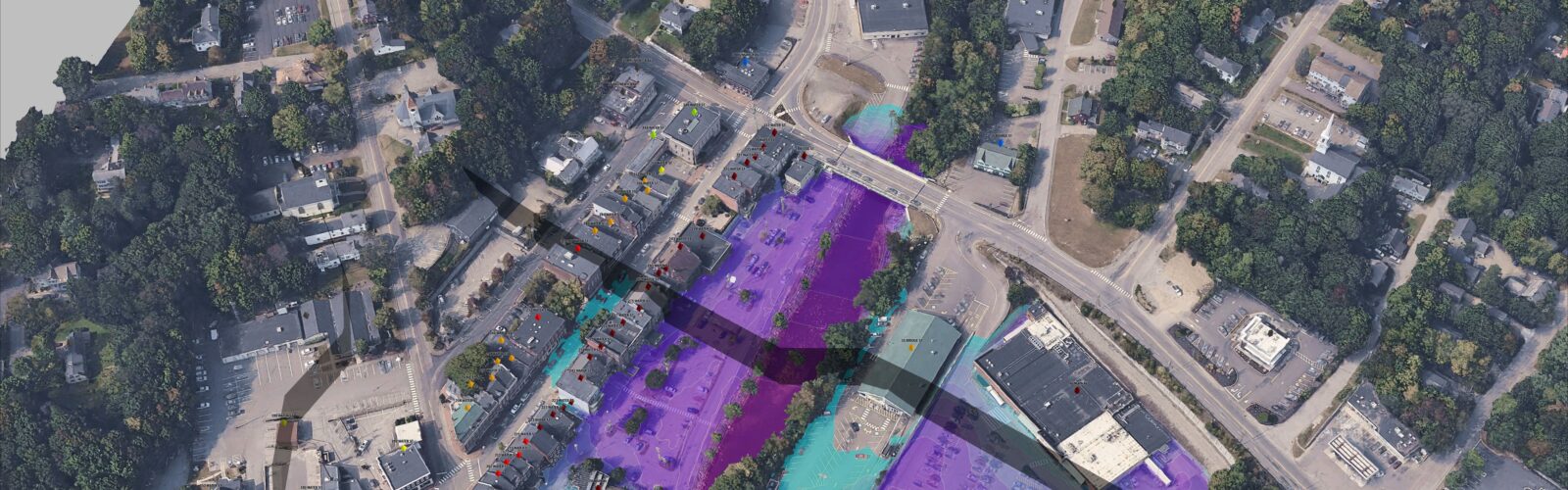
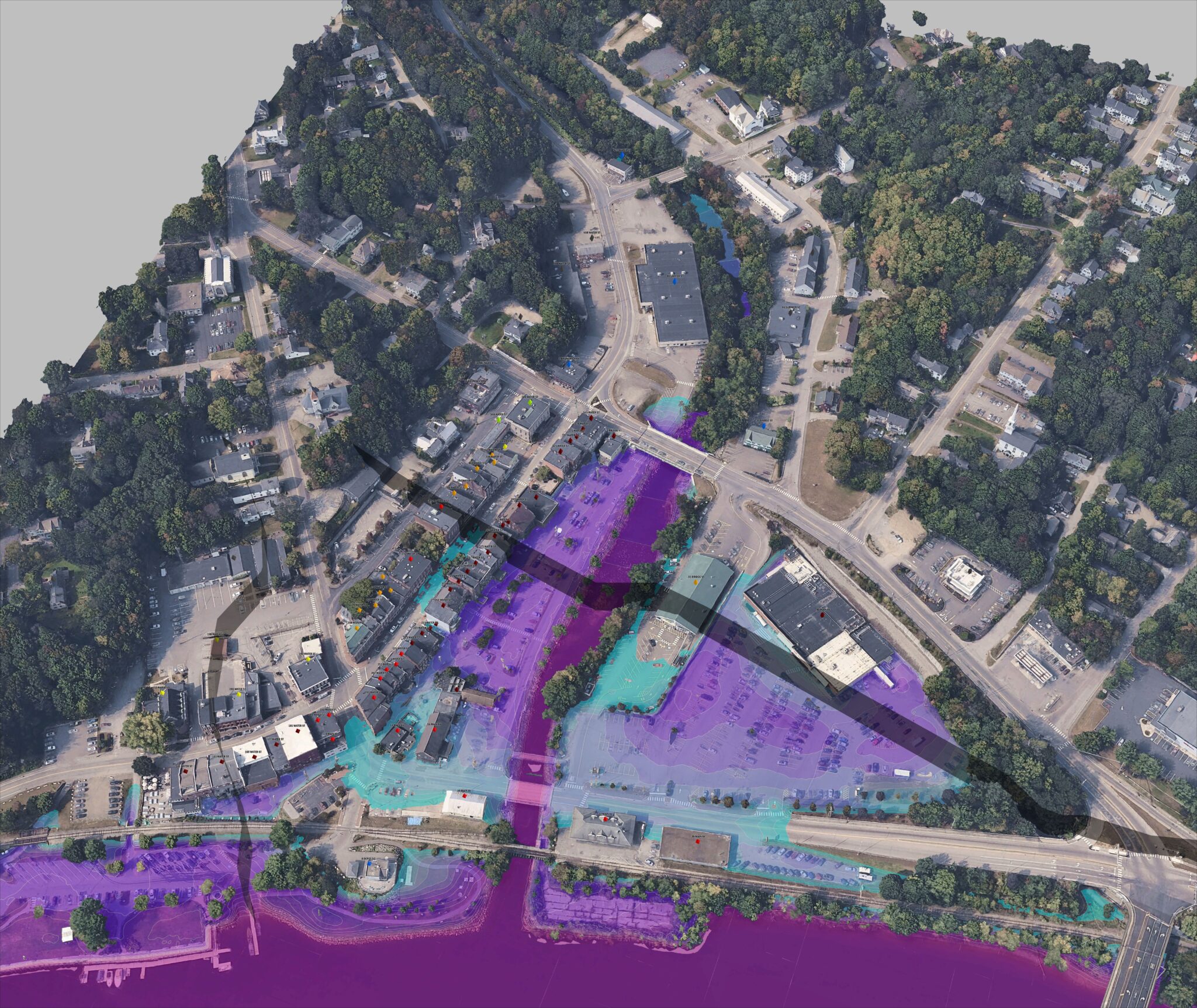
As part of this effort, Haley Ward completed an existing conditions analysis that included a review of City datasets such as parcels, utility networks, topography, and previous studies. The team also improved the accuracy of building footprint data and created a 3D mesh to visualize the downtown floodplain. An environmental hazards assessment followed, which involved reviewing USGS stream gauges on the Kennebec and Cobbosseecontee Rivers and mapping key historical flood events identified through archival research. The team then evaluated inundation impacts for multiple flooding scenarios and developed property-specific mitigation recommendations. These included wetproofing, dryproofing, elevating structures, or exploring repurposing/relocation, depending on the anticipated level of risk.
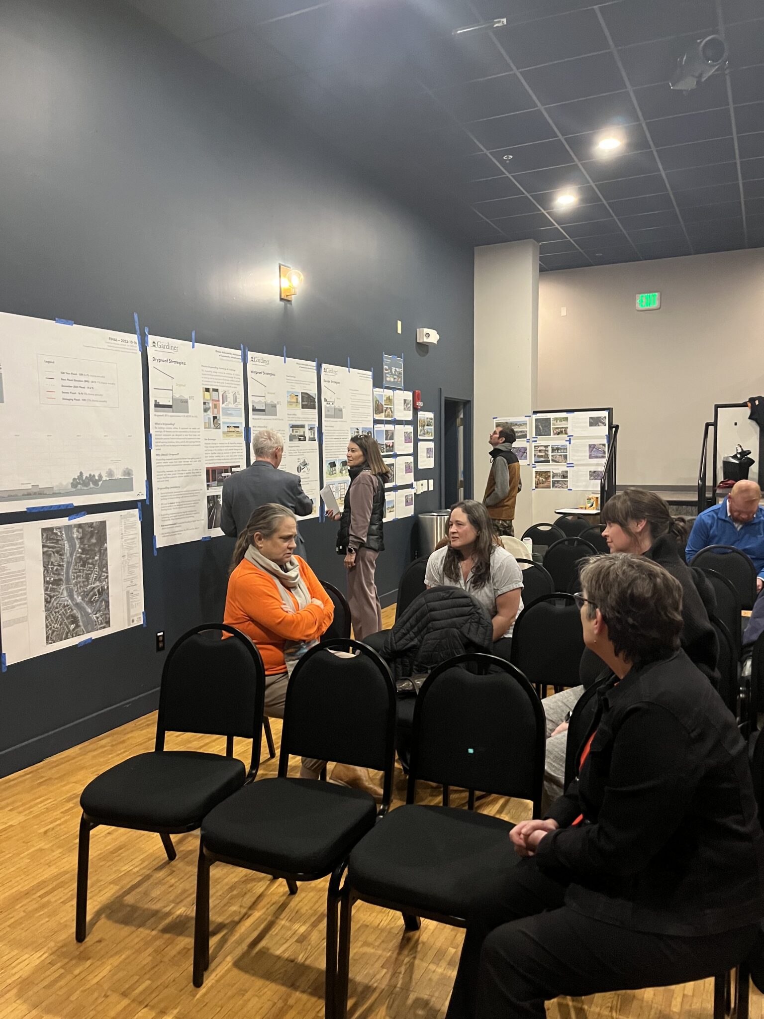
The project involved extensive public engagement in addition to technical analysis. Haley Ward facilitated two large public outreach events, along with one-on-one interviews and targeted focus groups with key stakeholders. These sessions were interactive and encouraged residents and business owners to explore the analysis directly and offer feedback. This approach created meaningful dialogue and helped shape the study. Gardiner had never completed an assessment of this type, and the collaborative format contributed to the strong response from both participants and the City.
The project presented several challenges. The flood risk level for the downtown area was among the highest for business districts throughout the State. Although the project was initially designed to focus on City assets exclusively, the project pivoted—with City and State support—to include the affected private properties as part of the analysis as well. This meant that we needed to provide some level of individuated risk analysis without the ability to visit and assess each property. Using LiDAR data analysis, FEMA base flood elevations, and historical flood record, we were able to estimate potential risk and inundation for each private structure quite effectively, using the most recent December 19th flood as corroborating evidence.
Community engagement was largely positive, although the volunteer work group sometimes found it difficult to contribute actively to discussions, which is a common situation for small municipal committees.
The final report includes:
- Executive Summary
- Environmental Hazards
- Community Vulnerability
- Risk Assessment
- Resources
- Appendix
Several important findings emerged throughout the project. Residents consistently expressed a preference for clear and simple communication. The team also found that complex models are only valuable when they improve understanding or support innovative solutions. Most property owners, for instance, were only directly concerned with the basics: how high is the water likely to get in my building given different scenarios? To allow each property owner to do that simply and efficiently presented a complex science communication problem. We were able, however, to use tables, diagrams, and maps to effectively circumvent this issue.
Gardiner will use this assessment to support future planning efforts. Property owners will be able to reference the findings to estimate their Base Flood Elevation and make informed decisions about improvements to their buildings. City officials will rely on the implementation matrix to guide future studies, prioritize projects, and strengthen applications for future grant opportunities. The overall goal of this project is to help Gardiner reduce risk, support its residents and business community, and build greater resilience to future environmental challenges.
Market
Services
Geospatial analysis
Hydrological inundation modeling
Environmental hazards assessment
Historical research
Community engagement
Asset assessment
Project Data
| Geospatial Analysis | Used GIS, LiDAR, and 3D modeling to evaluate downtown flood risks. |
| Hydrological Inundation Modeling | Modeled multiple flood scenarios and projected impacts. |
| Environmental Hazards Assessment | Evaluated river data, flooding history, and environmental risks. |
| Historical Research | Mapped historic flood events to support resilience planning. |
| Community Engagement | Led public outreach, interviews, and stakeholder meetings. |
| Asset Assessment | Evaluated vulnerabilities affecting public and private properties. |
| Risk Communication | Created maps and visual tools to communicate flood risks clearly. |
| Final Report | Delivered a vulnerability assessment to guide future resilience and planning efforts. |