Town of Wiscasset Waterfront Resiliency Plan
Project Scope
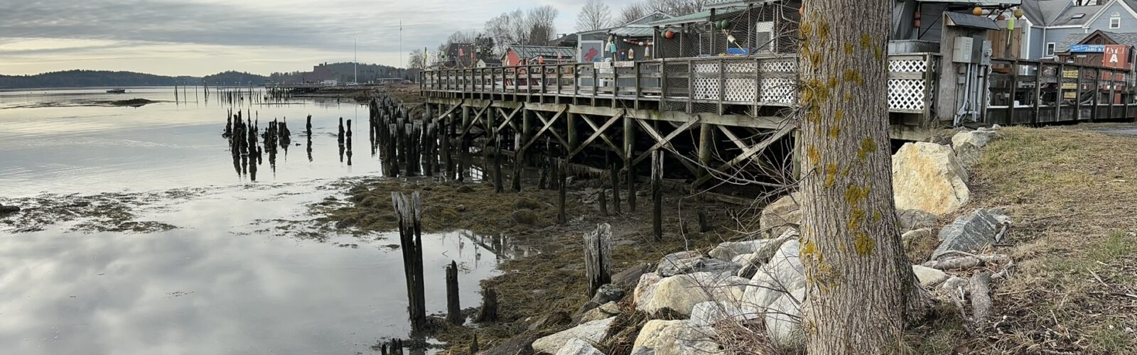
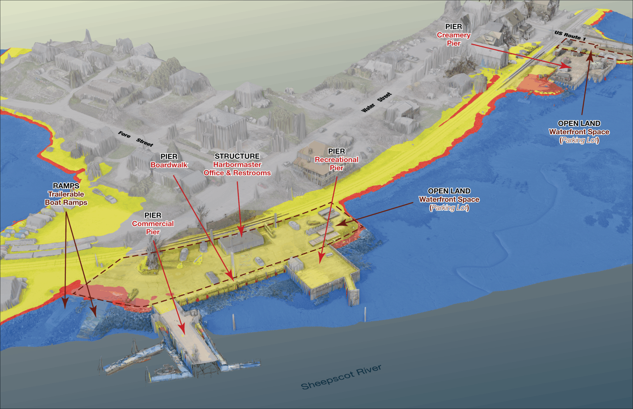
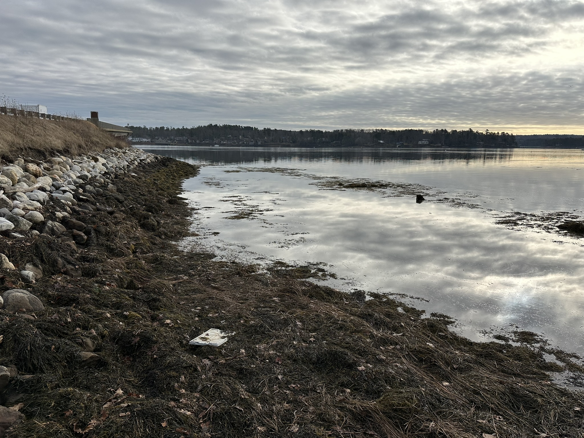
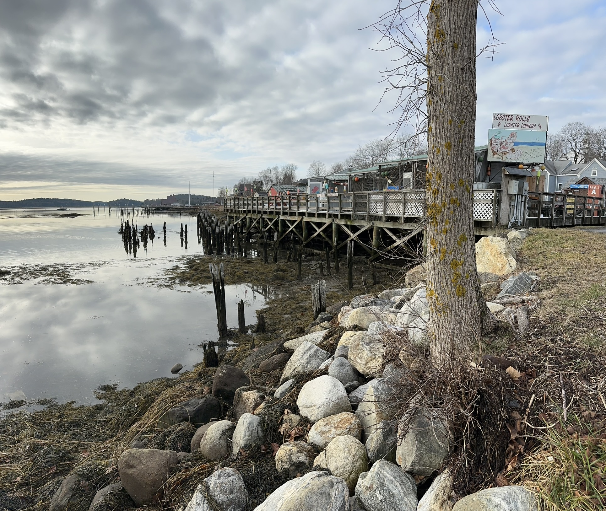
Recent flooding has affected communities across the State of Maine, including the Town of Wiscasset. Located along the tidal Sheepscot River, Wiscasset’s waterfront is central to its identity and local economy, offering access to recreation, supporting small businesses, and reflecting the town’s maritime history. Increasingly frequent marine storm surges have raised concern about long-term climate risks and the vulnerability of this critical area.
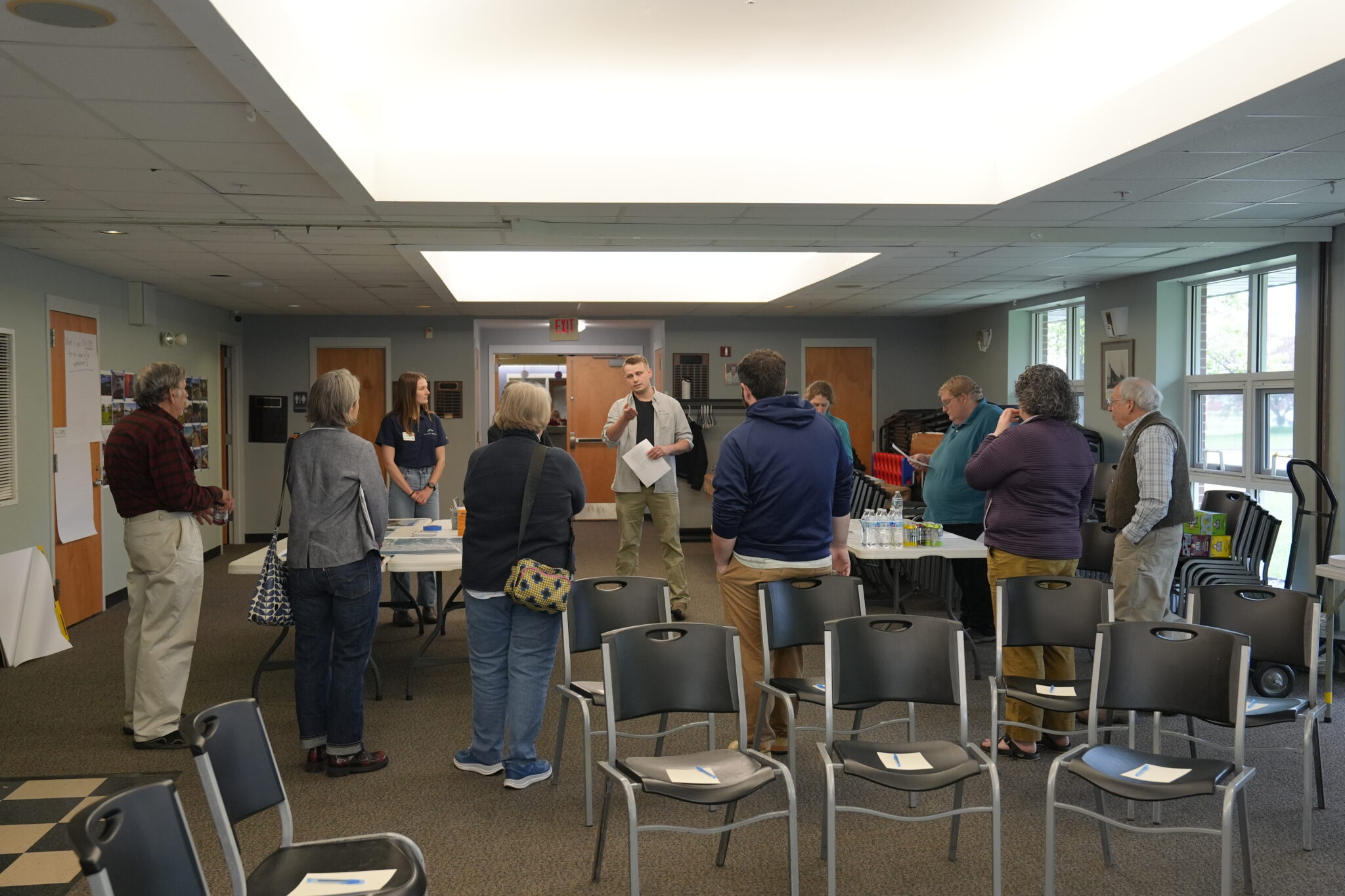
In 2024, the Town and its Climate Action Team partnered with Haley Ward to evaluate current and future flood risks and develop a path forward. Using reality capture, high-resolution flood inundation analysis, and geospatial modeling, the team identified key environmental hazards associated with rising sea levels and repeated flooding events. Early engagement included a project kick-off meeting that introduced the effort to the community, gathered local insight, and invited input from stakeholders to inform early concepts.
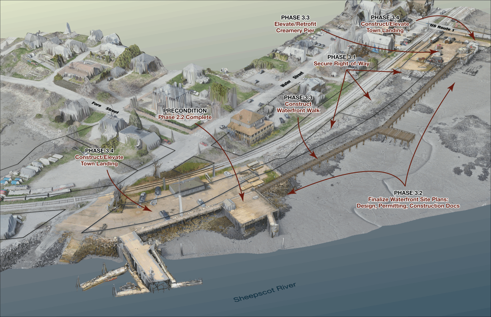
The project progressed through a series of focus groups and public meetings with the Waterfront Committee, Selectboard, Maine Department of Transportation, business owners, and residents. These discussions helped shape and refine a conceptual vision for the waterfront that reflects both technical findings and community priorities. The work culminated in a Waterfront Infrastructure Vulnerability Assessment that combines hazard data, public feedback, and a forward-looking plan for the area.
A key challenge was aligning a wide range of perspectives into a plan that participants could support. Stakeholders brought differing priorities and, at times, conflicting viewpoints. Through an inclusive and transparent process, the team built consensus around a practical and actionable direction. Another challenge was reframing a waterfront area facing significant flood exposure. Rather than being viewed as a lost cause, the plan presents a path that maintains the character and importance of this public space for years to come. The team also grounded the vision in feasibility, translating ambitious ideas into realistic, implementable concepts that balance long-term resilience with present-day needs.
The result is a community-supported roadmap that positions Wiscasset to respond to future flooding while preserving the waterfront’s role as a defining feature of the town. By combining technical analysis with meaningful public engagement, the project provides a clear direction for future planning, investment, and decision-making along the waterfront.
Market
Services
GIS/Geospatial Analysis
Environmental Science
Permitting & Feasibility
Planning & Design
Civil Engineering
Public Engagement
Project Data
| GIS & Geospatial Analysis | Used modeling and reality capture to assess current and future flood risks. |
| Environmental Science | Evaluated coastal hazards and impacts from sea level rise and storm surge. |
| Planning & Design | Developed a conceptual vision for a resilient, community-focused waterfront. |
| Public Engagement | Led meetings and outreach to gather input and build community consensus. |
| Stakeholder Coordination | Worked with local officials, agencies, and residents to align priorities. |