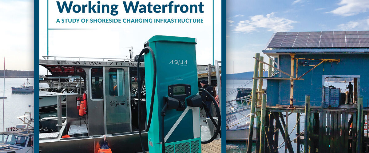
Shoreside Electrification
Coast of Maine
Project Scope
This project was completed in partnership with Homarus Strategies to evaluate the viability of electrifying marine propulsion systems across Maine’s coastline for a variety of commercial and recreational use cases. Commissioned by the Island Institute, the effort involved assessing potential sites statewide and developing analytical tools to better understand where marine electrification infrastructure could be most effectively supported.
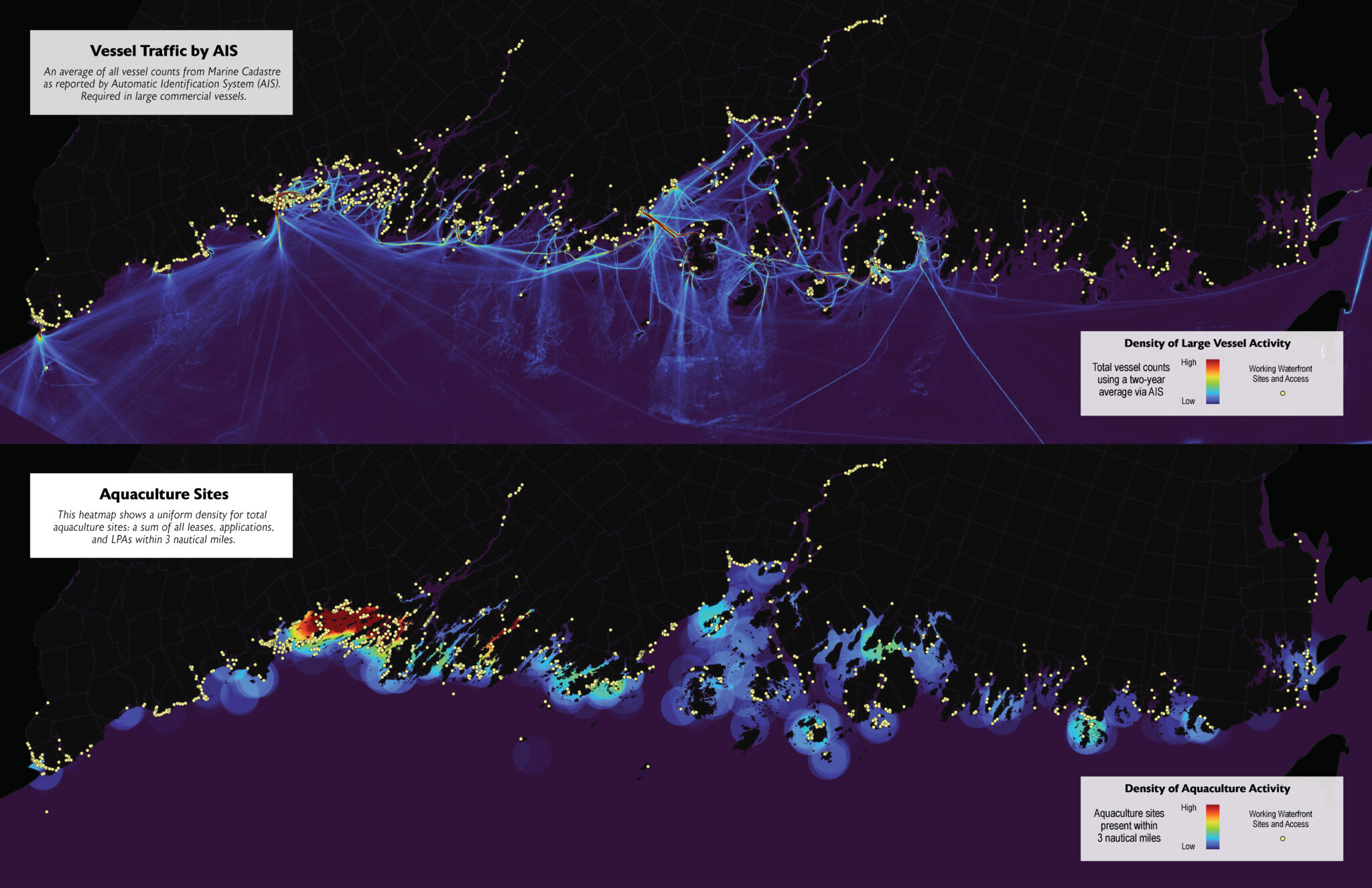
The project integrated a wide range of unique datasets, including Maine’s “Last 20 Miles” working waterfront inventory, Maine boat registration records, U.S. Coast Guard vessel registration data, and single- and three-phase power infrastructure data from Versant and Central Maine Power. These datasets were combined with additional information related to aquaculture activity, AIS vessel movement data, local amenities, and lobster landings from the Maine Department of Marine Resources to produce a series of visualizations, spatial analyses, and a comprehensive final report.
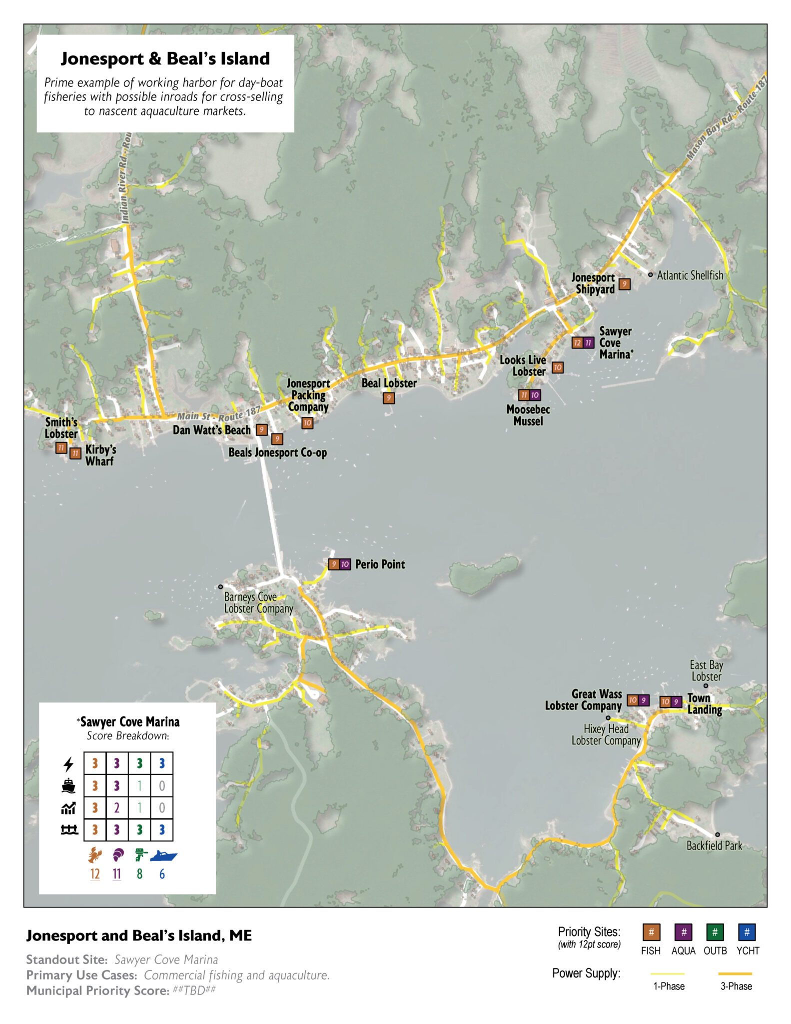
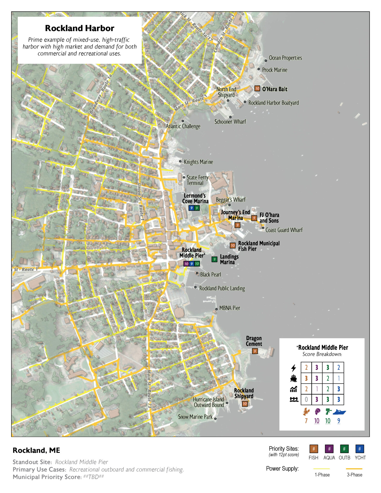
The final deliverables evaluated site suitability for several potential use cases, including dayboat fisheries, recreational outboard vessels, aquaculture operations, and large yacht recreation. A key component of the project was the development of a novel Multiple Criteria Evaluation (MCE) scoring system that enabled sites to be quickly categorized based on factors such as power availability, existing demand, market opportunity, and overall site conditions. The scoring framework was intentionally designed to be intuitive and actionable, allowing stakeholders to easily identify locations that ranked as optimal, good, fair, or poor for future electrification investment.
Spanning the entirety of Maine’s coastline, the project required the development of new analytical methods and evaluation approaches in an emerging area with few existing precedents. Rather than relying on an established framework, the team developed and refined the methodology collaboratively throughout the process, creating a practical and defensible system for assessing marine electrification opportunities at a statewide scale. The result was a highly customized planning and decision-making tool designed to support Maine’s evolving marine economy and future waterfront infrastructure investments.
Market
Services
- Multiple Criteria Evaluation (MCE) using grid capacity/proximity, market viability, user demand, and site suitability parameters.
- Geospatial analysis, cartography, geovisualization.
- Writing and communication.
Project Data
| Multiple Criteria Evaluation (MCE) | Developed a customized scoring system to identify and rank marine electrification opportunities along Maine's coastline. |
| Geospatial Analysis | Integrated and analyzed statewide datasets related to waterfront infrastructure, vessel activity, power availability, and marine industries. |
| Cartography & Geovisualization | Produced maps and visual tools to communicate site suitability and electrification potential. |
| Technical Writing & Reporting | Prepared reports and supporting materials documenting methodology, findings, and recommendations. |
| Decision Support Tools | Created a practical framework to help stakeholders evaluate future waterfront electrification investments. |